


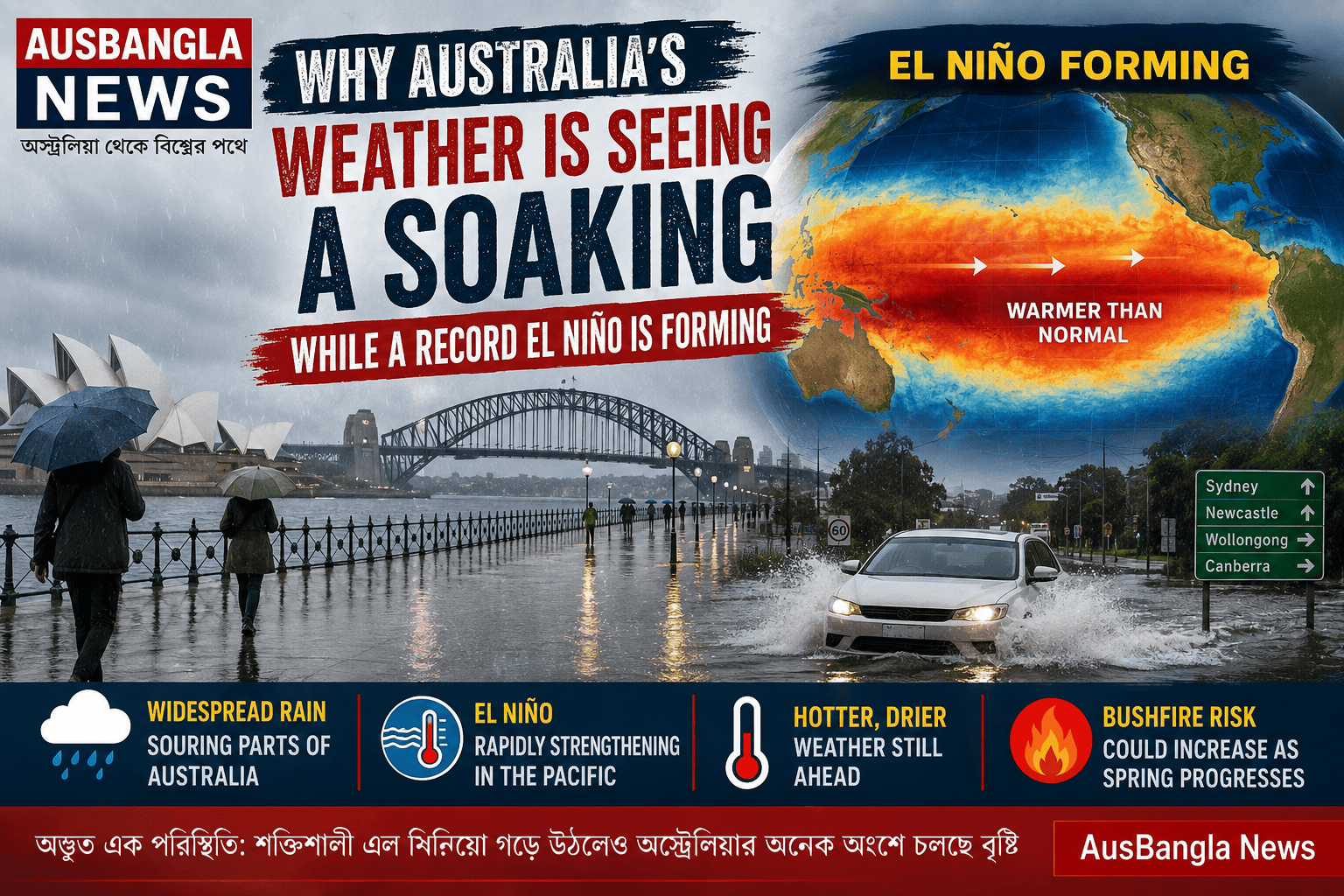

Australia is experiencing an unusual weather contradiction: widespread rain is soaking large parts of the country even as a rapidly strengthening El Niño develops in the Pacific — a climate pattern normally associated with hotter and drier conditions across much of Australia.
Another major rainband is moving across the country this weekend, following several widespread rainfall events earlier in 2026. Remarkably, Australia is now on track for what could be its wettest El Niño year on record, according to an ABC News weather analysis.
So why is it raining during El Niño?
El Niño does not mean that rain suddenly stops across Australia. Instead, it changes the probability and distribution of rainfall over months and seasons. Individual weather systems can still bring significant rain. This weekend, for example, a northwest cloudband that drenched Western Australia is moving east, bringing rain to parts of South Australia, Victoria, Tasmania, New South Wales and the ACT. Some areas could receive more than 40 millimetres. That means short periods of heavy rain can occur even when the broader seasonal climate signal points towards drier weather.
An El Niño that could break records
What makes 2026 particularly significant is the extraordinary speed and strength of the developing El Niño.
By late July, a key Pacific Ocean temperature index had risen to nearly 2°C above normal, representing the fastest-developing El Niño signal since 1900. Climate modelling has indicated the Niño 3.4 index could climb towards approximately 3.5°C during spring, potentially making this one of the strongest — or even the strongest — El
Niño events in the observational record.
The UK Met Office has also forecast that the developing event could become the strongest El Niño in living memory.
The rain does not mean the dry-weather threat is over. Despite Australia’s current soaking, the outlook could change considerably as spring progresses.
El Niño’s influence on Australian rainfall is generally strongest during winter and spring. Current seasonal modelling points towards reduced rainfall across much of eastern Australia in the months ahead, while temperatures are expected to remain well above average.
This creates an unusual situation: Australia may record an exceptionally wet El Niño year overall while still experiencing periods of significant heat and drying later in the season.
Bushfire risk remains important
Rainfall received earlier in the year provides an important buffer because much of Australia has not entered this El Niño following a prolonged nationwide drought.
However, a combination of declining rainfall, unusually high temperatures and drying vegetation during spring could increase bushfire danger in some regions.
Forecast modelling has indicated Australia’s spring mean temperature could be around 2°C above the 1961–1990 baseline, potentially challenging the national record for the hottest spring.
A reminder of Australia’s complex climate
Australia’s weather is influenced by far more than El Niño alone. Moisture from the Indian Ocean, northwest cloudbands, cold fronts, local sea temperatures and other atmospheric systems can temporarily overwhelm the broader El Niño signal.
That is why a powerful El Niño and widespread Australian rainfall are not necessarily contradictory. The bigger question is what happens next. As the Pacific continues warming and El Niño strengthens through spring, Australia’s current wet conditions could increasingly give way to hotter, drier weather and greater fire risk.
For now, however, Australians are witnessing one of the more unusual chapters in the country’s climate history — a potentially record-breaking El Niño developing while much of the nation continues to get soaked.























আপনার মতামত লিখুন :